About Us

About Mapx

MEET THE INNOVATORS LEADING TODAYS MAPPING EXCELLENCE.

HOW MAPX STARTED

Manage Your Assets, Properties, and Map It For Visualization or MapX is among the pioneering startup under the incubation program of Caraga State University’s Technology Business Incubator (TBI) – Navigatu. It is a translated product and service born out of the university’s previous successful large projects, namely: the Philippine Light Detection and Ranging II (Phil-Lidar II), Information and Communication Technology for Responsible Mining (ICT4RM), and the Comprehensive Land Information Management System using Geographic Information System (CLAIMS-GIS). In 2018, Caraga State University’s stellar researcher in emerging technologies, Dr. Rolyn C. Daguil, together with his team, propose and presented the creation of MapX. In early 2019, Dr. Daguil was among the chosen inventors to be part of the Leaders in Innovation Fellowship (LIF). This fellowship program aims to train and coach Filipino researchers in improving their startup and provide significant training and assistance in pushing their commercialization plan forward. It is a sponsored program by the Newton Agham Programme, Royal Academy of Engineering, Department of Science and Technology, and the Asian Institute of Management. True enough, after his graduation, Dr. Daguil had polished MapX’s basic business model and its initial services. In February 2020, the startup was granted and funded to operate initially by the Funding Assistance for Spin-off and Translation in Advancing Commercialization Program (FASTRAC), which is under the Philippine Council for Industry, Energy and Emerging Technology Research and Development (PCIEERD) of the Department of Science and Technology (DOST). This, however, leads to the founding of MapX and Dr. Daguil as the Project Leader of the startup company.

MAPX MANAGEMENT TEAM

Jeffrey T. Dellosa, M. Eng., PECE
 bUSINESS DEVELOPMENT AND strategy officer

Engr. Dellosa is one of the core people that introduced startup incubation in the University, together with Dr. Daguil. As a result, CSU became a recipient of the CHED funded project – ITech and DOST supported Technology Business Incubation (TBI) project – Navigatu, led by Engr. Dellosa. He is also a decorated researcher and a tenured faculty in the Department of Electronics and Communication Engineering under the College of Engineering and Geosciences. On top of his duty, he is also the Director in the Office of Technology Transfer and Licensing Office and the Project Leader for Intellectual Property Management Program for Academic Institutions Commercializing Technologies. Engr. Dellosa completed his Master in Engineering Program at the Ateneo de Davao University and finished his bachelor’s degree in electronics and communication engineering at the Mindanao State University – Iligan Institute of Technology.

ROLYN C. DAGUIL, Ph.D

Team Leader


Dr. Daguil has been in the teaching profession for the last twenty-two years with numerous capacities: as a professor, as a distinguished researcher, and as a project leader. His recent projects include the successful creation of Virtual Learning Facility Center, Information Communication Technology Support for Responsible Mining, and the United Nations funded projects: Eprima and AquaR. He is also an academic official where he is the incumbent Dean of the College of Computing and Information Sciences (CCIS) and the Director of Information and Communication Technology Center in Caraga State University. Dr. Daguil is an alumna of Hannam University in South Korea, where he earned his degree in Doctor of Philosophy major in Computer Engineering and Masters of Science in Information Technology. He received his baccalaureate degree in Computer Engineering at Mindanao State University, Marawi campus.

Alexander T. Demetillo, D. Eng., PECE
Team Head, Marketing

Dr. Demetillo is an electronics and communication engineer by profession but devotes himself in teaching young aspiring engineers. He is a former dean of the then, College of Engineering and Information Technology, a well-known researcher and an active member of several projects of the University. Dr. Demetillo was also a notable project leader of the research project Comprehensive Land Information Management System –using Geographic Information System. Presently, he is the setting chairperson of the Electronics and Communication Engineering Program of the College of Engineering and GeoSciences and the Director of the Center for Robotics Automation and Fabrication Technologies of Caraga State University. Dr. Demetillo garnered his Doctor of Engineering at the University of San Carlos, Cebu, his Masters of Engineering Program at the Xavier University and his undergrad in Electronics and Communication Engineering at the Mindanao University of Science and Technology.

Michelle V. Japitana, D. Eng., GE
Team Head, GIS

Dr. Japitana is the current Directress of the Office of the Planning and Development and a professor in the stellar lineup of engineers under the geodetic program of the College of Engineering and GeoSciences of Caraga State University. She is also a prominent researcher and has been involved in several enormous projects, specifically in Philippine Light Detection and Ranging (Phil-LiDaR) II Project, where she was the project leader and the Geo-Safer Project. Dr. Japitana finished her Doctor of Engineering at the University of San Carlos, Cebu. She had attended the University of the Philippines, Diliman for her Master of Science in Remote Sensing and took her undergraduate program of Geodetic Engineering at the Northern Mindanao State Institute of Science and Technology, now Caraga State University.


Rudolph Joshua U. Candare, MSIT, ChE
Team Head, AI Technology

Engr. Candare is a graduate of Chemical Engineering at the University of Philippines – Diliman Campus. Engr. Candare then pursued a research career and has been involved in different research projects. His recent involvement includes Philippine Light Detection and Ranging 2 Project, AquaR, and Eprima. Engr. Candare is one of the leading researchers in CSU, having won numerous best paper awards in national and international conferences. In 2018, Engr. Candare took a full-time teaching position under the College of Computing and Information Sciences, focusing on Artificial Intelligence and Machine Learning. He is currently the college extension officer of the College of Computing and Information Science, where research implementation is realized in response to the needs of the community. Engr. Candare earned his degree in Masters of Science and Information Technology at the Caraga State University.

Melbert R. Bonotan, MSIT
Team Head, Developer

Mr. Bonotan is a former programmer and senior science researcher of DOST funded projects, CLAIMS (Comprehensive Land Assessment and Information Management System), and Philippine Light Detection and Ranging (Phil-LiDar) 2 Project before his tenure in 2017 as a full-time faculty member of the College of Computing and Information Sciences. Presently, he is the operations manager of the CSU’s Technology Business Incubator (TBI) – Navigatu. Navigatu is an academic center under the College of Computing and Information Sciences that empowers students and young professionals to pursue an entrepreneurial career in response to the community needs and the social development goals (SDG). Mr. Bonotan took both his degree in Masters of Science and Information Technology and undergraduate program in Computer Science in Caraga State University.

MAPX DEVELOPERS TEAM

Dave Anthony P. Asis

Information Officer I

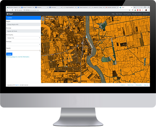
Dave is the lead programmer at MapX. He is responsible for the creation of the MapX platform (MapX main product) that hosts several unique features, all aiming for the convenience of its users. Currently, the platform BS in Information Technology introduces a much more Caraga State University convenient mapping services with cutting-edge technology.

John Sherwin C. Tadios

Computer Programmer I

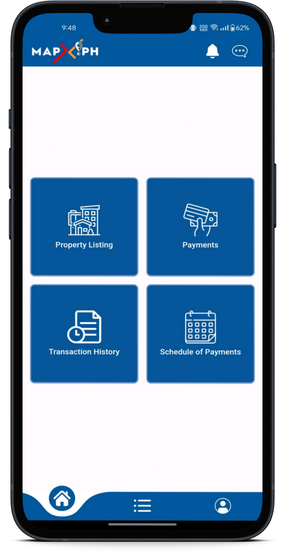
John is responsible for MapX mobile application. This is one of MapX core product that enables users to pay their tax obligation and anytime anywhere. Moreover, the app lets you tag and view land details more conveniently. Finally, you can set a schedule when to pay and be notified of your transaction.

MAPX GIS DEVELOPERS TEAM

Engr. Cherry Bryan C. Ramirez, Rea

ENGINEER I/ GIS ANALYST

Bryan is an engineer I and the GIS Analyst at MapX. Being a geodetic engineer by profession and a real estate appraiser, Bryan specializes in GIS and mapping technologies. He also contributed immensely to land laws, real property valuation and assessment, and visualization of maps.


ADRIEL ARLAN

ENGINEERING AIDE

Adriel is an engineering aide at MapX. He is a geodetic engineering graduate. Adriel is responsible for performing GIS activities such as data conversion and mapping, digitizing, attribution, editing, and textual encoding and read engineering CAD drawings and capture features into GIS.

gemer cabangil

engineering aide

Gemer is an engineering aide at MapX. He is a geodetic engineering graduate. Gemer is responsible for performing GIS activities such as data conversion and mapping, digitizing, attribution, editing, and textual encoding and read engineering CAD drawings and capture features into GIS.

mary jane tiempo

Engineering aide

Jane is an engineering aide at MapX. She is a geodetic engineering graduate. Jane is responsible for performing GIS activities such as data conversion and mapping, digitizing, attribution, editing, and textual encoding and read engineering CAD drawings and capture features into GIS.

gerome remetar

ENGINEERING AIDE

Gerome is an engineering aide at MapX. He is a geodetic engineering graduate. Gerome is responsible for performing GIS activities such as data conversion and mapping, digitizing, attribution, editing, and textual encoding and read engineering CAD drawings and capture features into GIS.

arjie molina

engineering aide

Arjie is an engineering aide at MapX. He is a geodetic engineering graduate. Arjie is responsible for performing GIS activities such as data conversion and mapping, digitizing, attribution, editing, and textual encoding and read engineering CAD drawings and capture features into GIS.

MAPX MARKETING TEAM

FERLYN M. DAGUIL

Project Development Officer I

Ferlyn is a marketing officer of MapX and is responsible for the planning and execution of the project’s marketing endeavors. She conducts validation in the Web app and Mobile app to the target client. She also assists in the RPU branding.

GLORY JOY P. CABATINGAN

Project Development Officer I

Joy is the marketing officer of MapX and is responsible for the planning and execution of the project’s marketing endeavors. She communicates closely with the clients to fully grasp their needs and create a better decision as to how MapX can be of better use to the stakeholders.

Daisy C. Baladad

Project Development officer i

Daisy is the hand and arms of MapX. She is MapX one-person team that handles the paperwork and supports the entire team in processing other pertinent documents.